Aquaboy
Well-known member
sorry but doesn't look very straight to me ...... more of a S


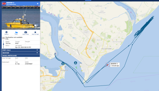
Dear JohnIf you can fancy a slow sail out of the Deben, this was my first crossing after the buoys were finally in position for 2024.
Spoiler alert, in case you can't stand the excitement, the shallowest part I found was before the Knoll Spit Port Hand Buoy which is the one nearest the Martello Tower.
There may be a deeper channel somewhere, but this is what you get if you stay close to the buoys.
John


Well done to all concerned. This service is of great benefit to many yachties and is much appreciated.
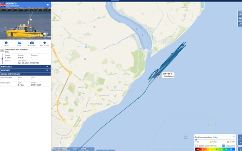
Dear JohnAnd finally, the seagull view.

Well done Peter, you work it out very carefully. There is still some checking to be done around the Knoll Spit buoy to see if the depths are better if cleared by a larger margin.
Photo of the first grounding this morning just by the Deben buoy.
Oops.
John